Friday, October 30, 2009

Opposition grows to PacifiCorp Dam Deal

Concerns are mounting that the recently unveiled Klamath Hydroelectric Settlement Agreement (KHSA) may not actually result in dam removal. Problematic provisions have been identified that could frustrate dam removal or delay it for decades. Klamath Salmon advocates also worry that by the time the dams actually come down Coho and Spring Chinook Salmon may have already been driven to extinction in the Klamath River Basin. Here is a summary of the main concerns which have surfaced so far:

• The KHSA does not make a commitment to dam removal. Instead it outlines a process by which the Secretary of Interior would make a decision in 2012 concerning whether dam removal is in the public interest. An increasing number of dam removal advocates are saying that this is not good enough. These activists want PacifiCorp and the Obama Administration to make a definite commitment to TAKE DOWN THE DAMS!

• The KHSA contains numerous provisions that could stop the process and allow PacifiCorp to back away from dam removal. Activists say these provisions could be used by PacifiCorp to indefinitely delay dam removal or even to avoid it altogether. Meanwhile the company would continue to reap profits while Klamath River Salmon continue to suffer from lethal water quality and inadequate flow below the dams.

• The KHSA would delay dam removal at least a decade beyond the time necessary to complete engineering and environmental impact studies. The only reason for the delay is to allow PacifiCorp to collect money for dam removal from its customers in Oregon and Northern California. Under the KHSA PacifCorp would continue to make profits during this period but would contribute no funds toward dam removal. Activists say that PacifiCorp stockholders should share bear part of the cost of removing facilities it owns and that the federal government should advance funds for dam removal and recoup those funds later from ratepayers.

• The KHSA does not adequately protect water quality or salmon during the decade-long period it proposes to delay dam removal. In fact, the Deal would in effect provide PacifiCorp with an exemption from the Clean Water Act. This in turn would prevent the North Coast Water Board from implementing the Klamath TMDL Clean-Up Plan it is currently developing. That Klamath Clean-Up Plan offers hope that the severe water quality problems which kill millions of young salmon every year might finally be addressed.

The dams are only part of that water quality problem – pollution from irrigation return flows and livestock operations create even more pollution than the dams. We can not clean-up the Klamath without addressing both Ag and dam-related pollution. Furthermore, Agricultural interests will rightly cry fowl if they are expected to clean up their pollution while PacifiCorp is allowed to continue business as usual.


Water polluted with livestock waste flows from a ditch into the clear water of Patterson Creek in the Scott River Valley

• The KHSA would absolve PacifiCorp from any and all liability associated with 100 years of powerhouse and power generation operations. Old power generation facilities often contain hidden toxic legacy which can be very costly to remediate. Activists say that it is OK to free PacifiCorp from liability for dam removal but they should remain liable for any toxic legacies associated with their operation of power generating facilities .

Connection to Water Deal Questioned

Grassroots activists and organizations are also questioning the wisdom of connecting the Dam Deal with the proposed Klamath Basin Restoration Agreement. Like KlamBlog, these activists and organizations realize that saddling dam removal legislation with the weight of controversial water allocations and costly cash subsidies could well sink the legislation or delay it in Congress for a long time.

The nearly $1 billion in subsidies and new programs included in the controversial KBRA will require shifting money from other tribes and other federal programs. That will be opposed by those other interests and programs because they would loose government funding as a result. The KBRA also requires nearly $500,000 in new funding – much of it for subsidies to the small group of wealthy irrigators who dominate Upper Klamath River Basin politics. Under congressional rules a congressperson or senator who proposing such spending will have to specify which programs will be cut to provide for the new spending. Cutting existing programs can be very controversial and all it takes is a single senator to put an indefinite hold on such legislation.

The KHSA and KBRA also include a provisions which would provide irrigators in the Upper Klamath River Basin with power from the Bonneville Power Administration. Because it is cheap Bonneville Power is coveted across the West. Those who currently have access to that power are vigilant lest they loose some of it. But the Dam and Water Deals both propose taking some of that power away from current industrial users and giving it to wealthy Klamath Basin irrigators. In response the Northwest Industrial Power Users Association – a trade group made up of internet firms and aluminum producers – has become involved in Klamath dam issues. This is a powerful and well connected lobby group whose opposition could kill dam removal legislation.

Termination of Tribal Rights

While the above list of problems with the proposed KHSA and KBRA are formidable they are not the least of the problems with these proposed deals. Exploding onto the national scene recently have been concerns about a waiver of rights which the four federal Indian tribes involved in dam negotiations – the Hoopa, Yurok, Karuk and Klamath Tribes - would be required to sign as part of the Deal. While the Yurok and Karuk Tribes argue that the waivers are conditional on funding and other aspects of the deals going forward, tribes across the US have become concerned about provisions in the KHSA which would allow the federal government to waive the rights of a dissenting tribe should the other tribes involved decide to sign the waiver.

This provision of the KHSA appears to be aimed directly at the Hoopa Tribe which has expressed serious reservations about the waiver of rights and about how the KBRA would impact Trinity River restoration.

The Hoopa Tribe may hold the trump card when it comes to Klamath Water Deals because they have the status of a state for purposes of the Clean Water Act. Because a portion of the Hoopa Reservation crosses the Klamath River above Weitchpec, the Hoopa Tribe’s water quality standards must be addressed. But the combination of KHSA provisions empowering the federal government to terminate the Hoopa right to decide for themselves whether to waive their water rights and the proposed suspension of the Clean Water Act discussed above could in combination render objections of the Hoopa to the Dam and Water Deals ineffective and irrelevant.

Indigenous activists like Chris Peters, president of the Seventh Generation Fund, have spoken out against an agreement that would empower the federal government to terminate the rights of a sovereign tribe without their consent. Many members of the three lower Klamath River tribes – the Yurok, Hoopa and Karuk - are related or have common ancestors. The three tribes also participate in each others traditional dances and ceremonies. Will the Karuk Tribal Council and Yurok Tribal Council go along with the consultants and staff who are telling them that it is OK to treat the Hoopa in this manner? Only time will tell.

You can read Chris Peter’s statement on “termination” of tribal rights in KlamBlog’s October 10th post below.

Termination of tribal rights without a tribes consent would set a modern national precedent and harkens back to days when Indians were treated like small children for whom the federal parent decided virtually everything. Both the Affiliated Tribes of Northwest Indians and the National Congress of American Indians recently passed resolutions in support of each tribes sovereign right to enter into or reject water agreements.

Widespread tribal attention to the proposed Klamath Deals calls attention to the broader context in which the Klamath Dam and Water Deals are being pursued. If one were to add up all the water to which western federal tribes have claim it would likely amount to about half of all the water in the West. But when that water was divided during past centuries those claims were ignored.

Over the past two decades the federal government has been systematically cutting deals with tribes across the West that are designed to make sure those tribal claims never are quantified or perfected. All of these deals involve tribes giving up water rights – or the ability to exercise those rights – in exchange for the promise of federal funding, restoration and – in the case of the Klamath Tribes - land. But in the modern world of water banks and water brokering those tribes which hang onto and perfect their water rights are likely to be much more wealthy than the wealthiest casino tribes of today. Still the allure of funding and the promise of restoration has proven difficult for cash strapped tribal governments to resist.

Seen in this light the Klamath Dam and Water Deals can be viewed as part of yet another vast swindle whereby Indigenous People are being divested of the most valuable right they hold – the right to life-giving Water. History may look back and condemn our complicity with this immoral federal project which has and continues to be implemented in Democratic as well as Republican administrations.

Tuesday, October 27, 2009

The Klamath on PBS - River of Renewal to air during November

River of Renewal - the award winning documentary about the struggle to restore the Klamath River and Klamath Salmon - will air on numerous Public Broadcasting Stations during the month of November. On November 6th the film will show nationwide on PBS World. You can check out all showing dates and times on line.

There is a lot more information about the film on the River of Renewal website. You can purchase a DVD of the film there too; River of Renewal DVDs make excellent holiday gifts! You can also learn more about Klamath River issues, how to get involved, where to get more information and how to contact the filmmakers on the web site.

If you have not yet seen River of Renewal plan to catch it on PBS during November or plan a party around one of the showings.

Thursday, October 22, 2009

Shasta Scott "License to Kill Salmon" Challenged

Below (after the photo) you will find a Press Release from 8 organizations which filed a challenge today to the California Department of Fish and Game's attempt to allow farmers and ranchers in the Shasta and Scott River Valleys to "take" Coho salmon in their agricultural operations.

The "Watershed-wide" permits CDFG is attempting to give farmers and ranchers in these Klamath River tributaries attempt to put rancher-dominated Resource Conservation Districts (RCDs) in charge of enforcing state law pertaining to dams and stream diversions. Farmers in the Scott River Valley have been denying Department of Fish & Game personnel access to the Scott River for many years now. CDFG has obeyed the rancher-farmer prohibition even though state law guarantees access to the navigable Scott River not only to CDFG employees but also to all citizens. Officials and ordinary citizens can float these rivers (when there is any water in them) but they can also walk, fish and recreate anywhere within the mean high water mark.

The right of citizens to use navigable rivers for travel, fishing and recreation is specifically guaranteed in the Act of Congress which admitted the new State of California into the United States. But like many laws of the land, the navigability law is not in effect in the Scott and Shasta Valleys.


The agricultural operations which the Department of Fish & Game seeks to permit include dewatering these rivers through a doubling of agricultural water use since 1960. Numerous salmon and steelhead - including Coho Salmon which are listed as "threatened" under state and federal endangered species laws - die each year when farmers and ranchers turn on stream diversions in the spring dewatering river sections below the dams and diversions. State law is supposed to keep that from happening but that law - Fish & Game Code 5937 - has not been enforced in the Scott and Shasta Valleys.

The Shasta and Scott Rivers are major Klamath River tributaries. The National Academy of Sciences has identified the Shasta and Scott River Basins as the places where Coho Salmon must be restored in order to prevent extinction of Klamath River Coho. Currently, wild Coho in the Klamath-Trinity system are at high risk of extinction with only one year in every three producing a spawning population large enough to maintain genetic diversity - one of the keys to salmon survival.


Plaintiffs in the lawsuit filed today include environmental and fishing groups and one federally recognized Indian Tribe - The Quartz Valley Indian Reservation (QVIR) - which is located in a portion of the Scott River Valley. The QVIR was illegally terminated in the 1960s via a fraudulent federal election but was reinstated as a federal tribe in 1980 as a result of a lawsuit brought by California Indian Legal Services.


Elders of the QVIR now passed on told of how the land was stolen by whites during the period of termination. When the Tribe was terminated by the federal government, reservation lands became the private property of the individual Indians living on the reservation. Many of the older folks were not literate. When they got sick they were taken to the hospital which at that time was owned by Siskiyou County. They were treated and taken home. Then the bill arrived.

Many of these elders could not read the hospital bills; they were not part of the cash economy and had no idea they were at risk for non-payment. Siskiyou County , however, foreclosed on the property for non-payment and white ranchers bought the prime agricultural land at auction. Other QVIR Indians lost the land through non-payment of taxes.


This scenario was not unique to the Scott River Valley. Across America the Eisenhower Administration terminated tribes and whites subsequently gained control of the land. Many of the terminations were later overturned in court but the land remained in the hands of whites. That is why the majority of land on most Indian Reservations today is owned by non-Indians.


The Dewatered Scott River near Fort Jones in June of this year
Note full-on sprinkler irrigation in the middle ground left of the photo


Klamath Riverkeeper ~ Earthjustice ~ Environmental Protection Information Center ~ Northcoast Environmental Center ~ Sierra Club ~ Quartz Valley Indian Reservation ~ Pacific Coast Federation of Fishermen’s Associations ~ Institute for Fisheries Resources

PRESS RELEASE

October 22, 2009

Contacts:

Erica Terence, Klamath Riverkeeper, 530-627-3311, erica@klamathriver.org
Glen Spain, PCFFA, 541-689-2000, fish1ifr@aol.com
Wendy Park, Earthjustice, 510-550-6725, wpark@earthjustice.org

Coalition Challenges State’s “Licenses to Kill Salmon” on Key Klamath River Streams. Agency proposal leaves threatened coho with dry riverbeds, impaired water quality


San Francisco, CA – A coalition of tribes, conservationists, and commercial fishing groups filed suit today in San Francisco Superior Court to block a precedent-setting agency proposal to strip endangered species protections from threatened coho salmon in northern California’s Klamath River watershed. The groups, represented by Earthjustice, oppose a plan by the California Department of Fish and Game (CDFG) to issue a blanket permit for agricultural practices that kill salmon or destroy habitat in the Shasta and Scott rivers, two of the Klamath’s key salmon spawning tributaries.

“These proposed permits are essentially licenses to kill salmon,” said Erica Terence of Klamath Riverkeeper, lead plaintiff on the case. “With conditions deteriorating for fish every year on the Scott and Shasta, CDFG should be proposing programs that expand protections for fish, not destroy them as these watershed-wide permits would do.”

This summer, the Scott and Shasta garnered headlines statewide after irrigation withdrawals caused record low flows and dewatered stretches of both rivers as thousands of salmon swam upriver to spawn. While local officials blame lack of rain for this year’s record low flows, peer-reviewed science shows that steadily increasing irrigation withdrawals are largely to blame for no-flow and record low-flow conditions in these rivers.

“This program amounts to a death sentence for salmon in both rivers.” said Glen Spain of the Pacific Coast Federation of Fishermen’s Associations (PCFFA), representing commercial fishermen devastated by fishing closures. “Instead of enforcing the laws, CDFG’s proposed program turns a blind eye to the practices that have driven Klamath coho to near extinction. CDFG should put an end to these destructive practices, not make them the assumed environmental baseline.”

The Watershed-Wide Incidental Take Permits (ITPs) at issue in this case would provide legal cover for continued de-watering of the Scott and Shasta while allowing illegal dams, water withdrawals, and livestock grazing in stream beds to continue unchecked. ITPs for coho salmon are required under the California Endangered Species Act (CESA) because the species is listed as threatened with extinction. Coho populations in the Klamath Basin have declined to roughly 1% to 2% of their historic abundance, with the Scott and Shasta rivers among their most important remaining habitat.

California currently issues individual permits to allow farmers and ranchers to continue lawful use of these rivers while threatened salmon are present, as long as their activities do not jeopardize fish survival and efforts are made to mitigate harm. But in the Scott and Shasta, the agency is planning a blanket waiver for all farming activities – without first determining whether any activities are harmful to salmon or even illegal. The program may be replicated by CDFG in watersheds throughout the state.

Terence suggested the new permits could actually undermine the good work done by Scott and Shasta landowners to restore fish habitat in the rivers, noting that “Fish screens and streambank restoration are good things, but they don’t help much if there’s no water in the river.”

“The agency proposal runs exactly opposite to the intent of the laws protecting our natural resources. Unfortunately, these permits as outlined by CDFG will ensure that conditions for threatened salmon will continue to erode in these key salmon watersheds,” said Wendy Park, attorney with Earthjustice.

The proposals have been in draft since September 2008. Tribes, conservationists, fishing groups, and the general public made frequent and substantive objections to the process, but CDFG failed to make significant changes in its final Environmental Impact Report released early this October. The agency’s action flies in the face of a 2004 National Academy of Sciences report suggesting that curbing agricultural water use and habitat degradation in the Scott and Shasta watersheds are critical for restoring Klamath River coho salmon. Indeed, the Shasta River was once the most productive salmon stream, for its size, in the state of California.

“This plan would also significantly undermine the efforts of the state’s Regional Water Quality Control Board, who were tasked with restoration of acceptable water quality in the Scott and Shasta under the federal Clean Water Act,” added Daniel Myers of the Sierra Club.

The suit comes on the heels of renewed concerns of another possible wave of fish kills in the Klamath Basin. Relatively high numbers of fall chinook salmon have returned to the Klamath this fall, even as the Shasta and Scott experience record low flows. Scientists found that low flows sparked the infamous September 2002 Klamath River fish kill that took the lives of some 70,000 returning salmon before they could spawn.

“We all want to encourage local landowner actions that help coho salmon recover in the Scott and Shasta, but this plan fails to deliver meaningful recovery actions for salmon. We cannot allow the state to just write off two of its greatest salmon rivers,” concluded PCFFA’s Glen Spain.

More information, references, photo galleries, and photos for download of the de-watered Scott and Shasta Rivers are available at http://www.klamathriver.org/tribs/ITP.html

###

Wednesday, October 21, 2009

Lost in the Klamath Deal swamp – The Lost River Basin

The Lost River Basin comprises about 20% of the total land area of the Klamath-Trinity River Basin. KlamBlog’s review of the proposed Klamath Water Deal indicates that – if that Deal is implemented as written – the Lost River Basin will be rendered an environmental and wildlife sacrifice zone.


The Lost River Basin is the area at the right center of the map straddling the Cal-Or line
Note all the surface water indicated in blue (Map courtesy of KRIS)
KlamBlog has also determined that, if the proposed Water Deal goes through as planned, it will be virtually impossible to reverse the sacrifice of Lost River Basin environmental and wildlife values. That is because the operative sacrifice provisions would be locked in via federal and state legislation already drafted as part of the proposed Water Deal.[1] While the Water Deal is not yet in final form, deal promoter Craig Tucker is reported in the press as stating with off-hand assurance that there will be no major changes from drafts previously released to the public.[2] Full text of the proposed Water Deal ( as well as the related Dam Deal) are available on line.

Some details of how the Lost River will become a sacrifice zone are presented below. The list is not complete. KlamBlog has not had the time, for example, to study proposed Oregon Legislation to determine if there are additional Lost River Sacrifice Zone provisions in that aspect of the proposed Deal or in the related Klamath Hydroelectric Settlement Agreement (KHSA) also known as the Dam Deal.

Historical Background:

In order to understand why and how the proposed Water Deal if adopted and implemented would render the Lost River Basin an environmental and wildlife sacrifice zone it is necessary to know a bit about the history of water development there.

The Lost River Basin was not always part of the Klamath River Basin. While water may have flowed from the Upper Klamath Basin to the Lost River Basin near Klamath Falls during extreme flood events, prior to the coming of white Europeans, the Lost River Basin was a completely self-contained basin with no surface outlet to any other water body.

We now know that Lost River Basin groundwater flows into and through volcanic tunnels. These full fledged rivers emerge to the South in the Fall River Valley. The streams then flow on the surface into the Pit River, a tributary of the Sacramento River. Water that originates in the Lost River Basin thus comprises a large part of the Pit River’s flow and a significant part of the water stored behind Shasta Dam near Redding, California.

The Bureau of Reclamation (BOR) changed the Lost River Basin in a manner that has made it an integral part of the Klamath River Basin. Beginning in 2005, the BOR began draining lakes and wetlands in the Upper Klamath and Lost River Basins to create irrigated farmlands. The main problem the BOR faced in this effort prior to the 1970s was too much water.

Each year water from Upper Klamath Lake and above flowed into the Lower Klamath Lake Area expanding the size of that vast waterbody. Likewise water from Clear Lake and the Lost River Basin uplands flowed into the then vast Tule Lake at the closed Basin’s lowest point.

In order to turn Lower Klamath Lake into farmland, the BOR used a railroad grade as a dike to prevent Upper Klamath Lake water from flowing into it. In order to turn Tule Lake into farmland the BOR first built the Lost River Diversion Canal and then a tunnel to pump “excess” water from the remnant Tule Lake (renamed a “Sump”) and through the Klamath Straits (renamed a “Drain”) to the Klamath River. In the absence of those facilities, the former Lower Klamath Lake and the former Tule Lake would flood – submerging the farmland the BOR had created and returning the land to lakes and marshes.

Because of the human manipulations described above, the Lost River Basin now consists not only of the lands actually in the Basin but also the lands to which Lost River and Klamath Project irrigation wastewater are now diverted and pumped. These include the Lower Klamath Lake, Klamath Straits and Keno Reservoir portions of the main Klamath River Basin. Most of the irrigation wastewater generated within the Klamath Project is collected in the remnant Tule Lake, pumped through Sheepy Ridge to Klamath National Wildlife Refuge and then dumped into the Keno Reservoir portion of the Klamath River via the Klamath Straits.

Sacrificed: Tule Lake and Lower Klamath NWRs:

Under the proposed Klamath Dam and Water Deals the Lost River Basin will be placed under the firm control of the so-called “On Project Irrigators” – the small group of wealthy irrigators KlamBlog calls the Irrigation Elite.

Section 15.1.2 of the Water Deal provides terms for the allocation and delivery of water to National Wildlife Refuges. Careful study of these terms reveals that water for the Klamath and Tule Lake National Wildlife Refuges will be under the control of the Irrigation Elite who can choose to dewater the refuges under specified conditions, i.e. when the Elite decides that there is insufficient water for irrigation by its members.

This section – as well as draft legislation included in the Water Deal’s appendices - also locks in commercial agriculture on the refuges and assures that these commercialized refuge lands will get water before the marshes and wetlands on which refuge waterfowl and other wildlife primarily depend.

Furthermore, this section provides that the Irrigation Elite can use Tule Lake and Lower Klamath refuges as their water treatment plant in order to meet obligations under the Clean Water Act. These well-off irrigators can also choose to supply the refuges with water “from other sources.” That would be the wells which the public gave these irrigators during the 2001 drought (California taxpayers) and under the $50 million Klamath EQIP provisions in the 2002 federal Farm Bill (federal taxpayers). The Irrigation Elite would – of course – want to be compensated by the government IF they choose to provide the refuges with water in this manner.

Sacrificed: Lost River Basin Groundwater

This member of the Irrigation Elite was protesting the first ever curtailment of water deliveries in 2001. Those who value the environment, fish and wildlife might take away a different meaning.

The Water Deal provides in section 15.2.4 for the protection of groundwater. This is necessary because – while the critical Drought Plan required by the Deal has intentionally not yet been written – it is clear to those who know the Basin’s water resources that it will be necessary to pump groundwater in order to meet the priority irrigation water allocation provided to the Irrigation Elite and also meet the minimum Klamath River flow needs of salmon and other fish during drought years.

Protection of groundwater is accomplished by monitoring a specified set of springs. If groundwater falls too low these springs will diminish or cease running. It is a good monitoring plan and it should be effective in preventing mining of groundwater in order to provide for irrigation and Klamath River flow.

Careful study of the Deal, however, reveals that all the springs which will be monitored are in or adjacent to the Klamath River. There will be no monitoring of springs in the Lost River Basin. But this is precisely where the US Geological Service is already on record that current levels of pumping are unsustainable, i.e. that the Irrigation Elite is already mining Lost River groundwater in order to market that water to (who else) the Bureau of Reclamation which then uses it to meet its ESA obligations without having to reduce irrigation deliveries.

This is one of the dirty little secrets of the Water Deal: Obscured by language protective of groundwater on the Klamath River side, the Deal would allow and even encourage the continued, unsustainable mining of Lost River Basin groundwater so that Klamath Project irrigation deliveries can continue at current levels and so that water for fish can be commoditized.

Sacrificed: Public Water Planning in the Lost River Basin

Section 15.2. of the Water Deal provides about a million dollars to the Irrigation Elite to develop an “On Project Water Plan”, that is, a plan to “align water supply and demand” for most lands within the federal Klamath Project. This section gives the Elite sole control of the planning and a million bucks to do it and only requires approval of the resulting plan by (you guessed it!) the Bureau of Reclamation – an agency which has never seen an irrigation proposal it did not like. This section of the Deal says groundwater will be protected but it defines impacts to groundwater so as to exclude impacts to Lost River Groundwater.
The Anderson-Rose Diversion Dam on the Lost River
This dam was built on top of the natural volcanic sill used by the Modoc Indians and by pioneers traveling the Applegate Trail
This section of the Water Deal creates a classic black box. Under its provisions, the Public will be excluded from water planning within the Lost River Basin. But the Public (taxpayers) will nevertheless pay so that the Irrigation Elite can plan the water future – including water commoditization and marketing – for 20% of the Klamath Basin, i.e. the entire Lost River Basin.

Sacrificed: Endangered Species in the Lost River Basin and Lower Klamath Lake Area
California legislation included in the proposed Water Deal (see section 23 and appendix A2) would provide the California Department of Fish and Game (CDFG) with the ability to allow the Irrigation Elite to “take” California fully protected species including but not limited to Kuptu and Tsuam (aka Lost River and Shortnose suckers), Bald Eagles and Golden Eagles.

Apologists for the Deal argue that this is simply extending the ability of CDFG to issue take permits as it does for other species – like Coho Salmon – which are listed under provisions of the California ESA but not “fully protected”. These apologists are correct; here’s the specific legislative language lawyers for the Irrigation Elite wrote into Appendix A2:

Section 2081.9 is added to the Fish and Game Code to read:
2081.9. (a) Notwithstanding Sections 5515 and 3511 and contingent upon the conditions set forth in (b) and (c), the department may authorize, under Chapter 1.5 (commencing with Section 2050) or Chapter 10 (commencing with Section 2800), the take of species in the Klamath River basin and those portions of the Tule Lake basin and Lost River basin that occur in California.
In other words, the Water Deal would provide the California Department of Fish & Game (CDFG) with the ability to do the sort of thing they are trying to do right now in the Shasta and Scott River portions of the Klamath River Basin. In the Shasta and Scott CDFG has decided to legalize the massive take of Coho Salmon which occurs each year via the dewatering of these key Klamath tributaries. That dewatering is occurring primarily as a result of a doubling of irrigation water consumption by irrigators since 1960.

The sort of mischief CDFG is engaged in on the Shasta and Scott would be exported under the Water Deal to the Lost River Basin and applied to the Irrigation Elite. Language added to the CDFG “take permit” program proposal at the behest of Scott River irrigators illustrates what this would lead to in the Lost River Basin:

"The Department will make every effort to work with Siskiyou Resource Conservation District and sub-permittee to correct or avoid such take [coho stranding] by some means other than reducing or ceasing the diversion and/or changing the timing or manner of the diversion."

Some promoters of the Water Deal are expected to be plaintiffs in litigation which will be filed soon to block CDFG from selling-out Coho on the Shasta and Scott. These individuals apparently do not believe that Kuptu, Tsuam and Bald Eagles are as important as Coho Salmon.

Based on its corrupt behavior on the Shasta and Scott, KlamBlog expects that CDFG will attempt to legalize take of Kuptu, Tsuam, Bald Eagles and other protected species by the Irrigation Elite in the following portions of the Lost River Basin IF the Water Deal and the California legislation included in that Deal is adopted and becomes law:

¨ Clear Lake: This natural lake is the source of the Lost River. It provides habitat for Kuptu and Tsuam as well as White Pelicans and other species.

¨ Lost River: Subject to channelization (straightening) by the Bureau of Reclamation, virtually every stick of vegetation has been removed from the banks of the Lost River. Nevertheless a few Kuptu and Tsuam are still found in the river.

¨ Tule Lake: The remnant Tule Lake is key habitat for Kuptu (Lost River Suckers). The "fully protected" status of Kuptu and Tsuam puts some limitations on the Irrigation Elite which use the remnant lake – aka Tule Lake National Wildlife Refuge – as an agricultural sump and agricultural sewage pond.

¨ Tule Lake and Lower Klamath National Wildlife Refuges: These refuges host and provide food for as many as 1,000 or more wintering Bald Eagles. Studies conducted by the US Fish and Wildlife Service during the Clinton Administration found that failure to provide these refuges with the water they need results in “take” of Bald Eagles. Eagles die when the refuges are dewatered because their main food source – ducks and geese – move down to the Central Valley and Salton Sea when the Klamath refuges are dewatered. The eagles, however, do not leave; they starve to death. Although this “take” is illegal under California law no environmental organization has yet filed suit to keep the refuges from being dewatered and thereby to save starving Bald Eagles.

-->
-->

KlamBlog has presented above information from the proposed Water Deal which we believe makes the case that those who support and promote the Deal are colluding to render the Lost River Basin an environmental and wildlife sacrifice zone. The conservation groups which have signaled that they are ready to endorse this abomination in the name of Klamath Dam removal include (in alphabetical order) the following organizations:
  • American Rivers
  • California Trout
  • National Center for Conservation Science and Policy
  • Northern California/Nevada Council Federation of Fly Fishers
  • Trout Unlimited.
KlamBlog invites representatives of these organizations to defend themselves here. We welcome their submission telling KlamBlog’s readers why they think the analysis above is in error or alternatively why they think it is OK to sell out one area and river in order to “save” another area or river.


Prayer Pole at Captain Jack's Stronghold, Lava Beds National Monument, Lost River Basin. The Stronghold looks north over what was once the vast Tule Lake and the Modoc Tribe's winter village. The area is now mostly farmland dominated by the Irrigation Elite


[1] Proposed federal and state legislation to implement the Klamath Deals has already been drafted. See Appendix E, G1, G2 and G3 of the proposed Klamath Hydroelectric Settlement Agreement (KHSA) – the Dam Deal; and Appendix A1. A2 and A3 of the proposed Klamath Basin Restoration Agreement (KBRA) – the Water Deal. Both are available at www.edsheets.com.
[2] The Klamath Water Users Association (KWUA) Board of Directors voted over a year ago not to agree to any major changes to the Draft Klamath Basin Restoration Agreement (the Water Deal). KWUA represents the Irrigation Elite in Klamath negotiations.

Wednesday, October 14, 2009

“No Major Changes” in Klamath Water Deal!

-->
If anyone had hopes that there would be changes made when negotiators meet to finalize the Klamath Basin Restoration Agreement, they will be disappointed – that is if you believe that Craig Tucker, spokesperson on Klamath River issues for the Karuk Tribe, knows what he’s talking about.

In the wake of the much anticipated agreement on PacifiCorp’s five Klamath River dams, Tucker has been flying around the region in the company of PacifiCorp Vice President Dean Brockbank. The media tour – which also included a representative of the California Department of Fish & Game - was conducted to promote the proposed Klamath Dam and Water Deals.
At a tour stop in Klamath Falls Tucker told the Klamath Falls Herald and News that “No major changes would be made” in the controversial Water Deal when negotiators meet in “two or three weeks.”
The Klamath Basin Restoration Agreement – also know as the Water Deal – has garnered bitter opposition from many irrigators in the Upper Klamath River Basin and a few in the Shasta and Scott Valleys because it provides irrigators who receive water via the federal Klamath Project – the On-Project Irrigators – with a guaranteed, first-in-line allocation of water, access to cheap power and $100 million dollars in subsidies. Opponents believe this will give On-Project Irrigators an unfair competitive advantage. That advantage in turn is expected to further solidify On-Project Irrigators status as the Klamath River Basin’s Irrigation Elite.
Represented by the Klamath Water Users Association, members of the Irrigation Elite lease farmland at very low rates on both public refuge and private land mostly in the Tule Lake and Lower Klamath portions of the Upper Klamath River Basin.

The Off-Project Irrigators are also targeted in the agreement for retirement of water rights while no such reduction would be asked from the Irrigation Elite. This will allow the well-healed On-Project Irrigators to continue to lease vast amounts of farm and refuge land – some from older folks who can no longer farm - at very low per acre rates. Land the Irrigation Elite leases comes with water supplied by the US Bureau of Reclamation – another advantage.
The fact that Craig Tucker was traveling with PacifiCorp’s Vice President will strike Klamath watchers as ironic. Just a few months ago he was skewering and demonizing the company and its executives on a regular basis - including during protests at the company’s headquarters in Portland and in the Omaha home town of PacifiCorp’s chief shareholder - Warren Buffett.
The deal Tucker is now heaping praise upon lets PacifiCorp shareholders off the hook for all liability connected with removing the company’s dams and powerhouses from the Klamath River. Instead it saddles PacifiCorp’s electric customers with much of the financial burden. If the Dam Deal Tucker promotes is ratified by Congress, Warren Buffett and PacifiCorp’s other shareholders will walk away without having to pay even a penny for removing the dams and powerhouses it owns.
Although public utilities commissions ordinarily allow power companies to recover the cost of environmental mitigations from their electric customers (along with 9% profit) in this case the costs of relicensing mitigations (estimated at $400-$500 million), the post relicensing operating loss (estimated at $40-$50 million per year) and the cost of dam and powerhouse removal (estimated at $250-$500 million) are so high that it is likely the California Public Utilities Commission and Oregon Public Utilities Commission would have balked at saddling electric customers with the full cost. In that case PacifiCorp shareholders would have had to bear a portion of the cost.

This reveals part of PacifiCorp’s motives for cutting the Dam Deal. Company spokespersons have claimed ad nauseam in the media that PacifiCorp's main motivation is looking out for "the best interests of our customers". But, as Shakespeare had Hamlet's mother quip: "The lady dost protest too much, methinks!"

Previously Tucker and Yurok Spokesperson Troy Fletcher had contrasted the wealth of Warren Buffett with the pervasive poverty which persists on the lower Klamath River where the two tribes are based; now these two individuals – and the Tribe’s they represent – appear ready to agree to saddle some of these same folks – including many of their own tribal members - with the cost of dam and powerhouse removal while PacifiCorp shareholders pay nothing.
But no reporters apparently questioned Tucker on this point; nor did media reports of the Tucker-PacifiCorp aerial tour reveal whether the group traveled on public airlines or on one of PacifiCorp’s corporate jets.

Sunday, October 11, 2009

Death of a Lady - the histroy of the Scott River's destruction

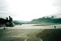
Recent posts on Scott River conditions and history have prompted several comments and questions. Below KlamBlog reprints one of the comments and responds to it. Following that is an article penned in the 1970s about the Scott River and its anadromous fishes by Jim Denny, the grandson of a prominent Scott River Valley pioneer family.
________________________

Joe G said:

Another well researched story. I also enjoy Chris Peters view of the agreement. For your next story, I wonder how long has it been since there were more natural flows in the Scott? Is it just the fourth crop of alfalfa, or are there other factors that have changed in the Scott Valley as well? This leads to just what would have to happen in the valley to insure proper flow? Would it mean taking only two crops of alfalfa in dry years? Is there another way to provide water to cattle other that these wasteful ditches(there must be!)? Are the tribes weighing in on the Scott issues?

Hope the predicted rainfall this week helps these fish get upstream. Meanwhile, I will stay tuned to Klamblog. Keep up the good work!

____________________________

KlamBlog Responds:

Dear Joe G, The dewatering of the Scott River began in the Gold Rush era (1850s) when miners dewatered the river with dams to access the dewatered bed and to wash soil for gold. It let up when the Gold Rush ebbed but the settlers who had come to raise cattle and grain to feed the miners diverted the river's flow and that of tributaries.

Extensive pumping of groundwater for irrigation began about 1960 and has increased steadily since then - especially in the late 70s and 80s. For example, in the 50s the entire Lower Moffett Creek Watershed was dry farmed (this is the area along both sides of State Route 3 between the town of Fort Jones and Forest Mountain (the pass to Yreka). Today that entire area is irrigated; most is in alfalfa. This history is why we speak of the "progressive dewatering" of the Scott River.

Ken Maurer who was a member of the Scott River CRMP and Marble Mountain Audubon mapped late summer and fall flows in the Scott River by decade going back to the 40s when the flow gauge below the Scott River Valley was established (USGS data). His hand drawn graphs showed that flows have decreased decade by decade since the 1940s.

We believe this reality is illegal under several laws - most notably Fish & Game Code 5937, the Wild and Scenic Rivers Act (lower Scott River is a federal WSR designated because salmon were the rivers #1 "outstanding and remarkable value") and the Mono Lake Decision (Public Trust). The responsible state and federal officials know this but they don't have the guts to do anything about it. KlamBlog believes they are morally - if not criminally - negligent.

As for the solution, we believe these are the elements:

1. The Forest Service (or anyone acting in the public interest) should challenge the Scott River Adjudication. The FS right to flows in the river is not being met even in average rainfall years. But the FS water right has a riparian basis and in California riparian rights have precedence over rights based on appropriation. Many of the Scott Valley Agricultural water rights - currently given precedence over the FS riparian right - are appropriative rights. The judge erred in the Scott Valley Adjudication Decree and this needs to be corrected.

2. The adjudication judge also erred in how he defined groundwater interconnected to surface flow. In many instances the line defining interconnected groundwater in the adjudication is located right next to the river. This in spite of scientific evidence (USGS and California DWR) that in the Scott River Valley groundwater is "broadly interconnected" to surface flow. This drawing of the line was recommended by California Department of Water Resources. We suspect corruption played a part. In any case this error in the Scott River Adjudication Decree needs to be corrected.

3. All groundwater pumping must be regulated otherwise those who loose surface rights will just switch to groundwater. Currently Siskiyou County and the state refuse to regulate groundwater even though there is clear scientific evidence from USGS and California DWR that groundwater is broadly connected to surface flow via springs which dry up when the water table is lowered too much.The groundwater study mandated by the Scott River TMDL has been given over to Siskiyou County. The study is well behind schedule already and will, in my opinion, never be completed by Siskiyou County unless there is a court order telling them to complete it by date certain.

4. We need a BASIN WIDE FLOW ASSESSMENT for the Klamath River Basin as recommended by the second independent science report on the Klamath from the National Research Council. That flow assessment would determine the flows actually needed for fish in the Scott River and major tributaries and throughout the Klamath River Basin based on up-to-date scientific methods. The results would then go to the adjudication judge with a request to adjust the Forest Service's riparian-based river flow water right as per California law.

On your next question, there is indeed another way to water cattle. As part of the Scott Valley CRMP KlamBlog's principle author worked to establish an alternative stock watering system whereby the Siskiyou RCD gave smaller pumps (sometimes solar pumps with solar panels) to livestock owners so that they would not need to divert surface flow in winter in order to water livestock nor turn on the expensive irrigation pumps. Unfortunately the Siskiyou RCD did not require that those receiving these taxpayer funded systems agree not to divert outside irrigation season. As a result most of these livestock producers use the wells but still divert and still allow their cattle access to the river. It is a sad tale colored by corruption; but there it is.


A steer watering in Big Slough in the Scott River Valley in winter.
Note the hundreds of cattle in the background and the cattle exclusion fence which has been taken down.

_______________________

Below you will find an article titled “Death of a Lady” about the Scott River. This article was written in the early 1970s for fishermen by Jim Denny, now long deceased. Jim was an avid steelhead fisherman and a public school teacher. He was also the direct descendant of Scott Valley pioneers.

KlamBlog doesn’t know if the article was ever published. We do know that irrigation interests in the Scott River Valley would rather that it be forgotten. Jim’s daughter, Mary Roehrick Denny, is a member of the Scott River Watershed Council – a group which insists on providing cover for those who are illegally dewatering the Scott. This is being done in the name of "collaboration" and “win-win”. The Scott River and its salmon, however, continue to loose.

You also ask "Are the tribes weighing in on the Scott issues?" The answer is "yes" and "no". The Quartz Valley Indian Reservation (QVIR) has been documenting Coho "take" which results from dewatering of Scott River Valley streams. It does not appear that the "responsible agencies" are going to do anything with that data.

The Yurok Tribe and Karuk Tribe agreed not to study flow needs in the Shasta and Scott River as part of the flow assessment of the Klamath River which began in the late 1990s. That decision prompted the National Research Council to state that the Klamath River is being treated "like the Upper Basin and a gutter to the sea."

These two tribes - and all other members of the deal-making Klamath Settlement Group - agreed not to include the Shasta and Scott in the proposed Klamath Basin Restoration Agreement (KBRA). The word is that the California Department of Fish and Game insisted that if the Shasta and Scott were included they would quit the negotiations. The tribes, the fishing groups and the environmental groups - including the Pacific Coast Federation of Fishermens' Associations, Cal Trout and Trout Unlimited - did not call CDFG's bluff.

Based on the above facts, I think it is likely that the QVIR will continue to advocate for the Scott River and its salmon and that the Yurok and Karuk tribal governments will continue to take no meaningful action to restore Scott River flows.

_______________________

The article below, written by Jim Denny for a fishing magazine in the mid 1970s, is about California’s Scott River, a major tributary of the Klamath River.

Descended from a pioneer Scott River Valley family, Jim Denny was a teacher, fisherman and historian. The article gives an historical perspective on salmon and steelhead fisheries in the Scott River Valley. The “silvers” referred to in the article are Spring Chinook salmon, this being the local name for Spring Chinook.


The Death of a Lady
By Jim Denny

In the world of the fisherman, a stream is always of the feminine gender. This situation exists because the only part of his life more important to him than fishing is his wife. The lady I am going to tell you about lives in Scott Valley. She is called Scott River.

The first white person fortunate enough to see this beauty with his own eyes was Thomas McKay, who came through the area for the Hudson Bay Company in about 1830. McKay must have been taken by our lady’s charms, for in 1836, ,he returned with Stephen Meek to trap beaver. In one month they secured 1800 pelts. McKay and Meek called the home of our lady Beaver Valley.

Had it not been for the discovery of gold by John Scott in July or August of 1850, our lady most likely would have been named Beaver. Let’s picture, fellow fisherman, what McKay and Meek actually viewed in the valley they called Beaver.

It is 1836. The valley is thirty-five miles long, five to seven miles wide, with an almost completely level floor. The north end of the valley is a solid mass of beaver ponds and willows. The south end is grassy meadows, oak, pine, poplar, cottonwood, birch, alders, and willows. The mountains around the valley are forested in pine, fir and cedars. Besides the fur-bearing animals in the valley, quail, grouse, geese, ducks and deer are everywhere.

In 1855, the commanding officer at Fort Jones used to detail two soldiers to shoot ducks for two hours. In this length of time, they killed enough ducks to last the garrison of fifty men a week. This vale of beauty, then, is the home of our heroine, Scott River.

Imagine you are standing on a hill overlooking her, back in 1836. it is a sight to speed your heart, raise your blood pressure and make you want to go fishing right now. The long, meandering curves, sparkling riffles – all together they combine to form the premier river in the state of California.

It is granted that the home of our lady was a house of the utmost splendor and grandeur in 1836. What, then, clogged the sluice boxes, got in the way in the irrigation ditches, smelled up the fields when they died, and on top of that, killed half the dogs. I remember when my Dad wanted smoked steelhead, he merely went out into the fields where he was irrigating, picked up twenty to thirty downstreamers, and took them to the smokehouse.

This was in March and April. In June and July, the salmon smolts came down the ditch in such numbers that the ground was white, as they lay in death after the water was turned off. Calvin Ball used to drive his spring wagon right into French Creek. It then took him all of thirty minutes to pitchfork in a load of spawning silvers. Then he fed them to the pigs.

Most of the ranchers also liked salted steelhead. Jack Timons told me they used to take a spring wagon, two fifty-gallon barrels, one man with a pine torch, and two men with spears, and also go to French Creek, only at night. At the most, it took them two hours to fill the barrels with de-headed, cleaned, spawning steelhead. That gave them enough salted steelhead to last the whole year. This size crew could spear two months on French Creek today and not cover the bottom of one barrel.

Bill Burcell tells me the spring run of steelhead in Etna Creek was so great you couldn’t see the bottom of the creek for their green backs. Today it’s a problem to see one fish.

When the Miles family wanted fish, they took silvers from Miners Creek. Bill and Albert went with their Dad. Each had a spear. Their Dad would point out which fish to spear. Albert says it took them an hour to get enough selected salmon to last a year. Today the number of silver salmon in Miners Creek is zero.[1]

Yes, our lady’s arteries and veins were glutted with fish. The silvers came from September 20 to the first of November. The kings came from October 1 to December 15. The steelhead started October 1 and ended June 1. The German brown ran in Shackleford Creek in April and May. On top of all these anadromous fish, Scott River had an extremely large population of native rainbow trout. The river was full of three to five-pound trout that were broad, deep and extremely red-meated. I remember one five-pounder I caught that had twenty-six crawfish in its stomach, and was only twenty-one inches in length.

The tributaries all had large populations of their own sub-species of rainbows. Kidder Creek had Dolly Vardon in its upper reaches. Today, Fish and Game says five-thousand steelhead, one-thousand silvers, and eight-thousand kings come into Scott River. No fish counts were made one-hundred and fifty years ago, but my estimates are as follows: two-million steelhead, three-hundred and fifty-thousand silvers, and fifty-thousand kings. I do not think all these fish succeeded in spawning. I do think that many of the fish spawned and destroyed the redds of previous spawners. I question Fish and Game’s figures on steelhead. I suggest that the present run is twenty-thousand. I think they are accurate on the kings and high on silvers.

For all practical purposes, the native rainbows and the silver salmon run are gone. Why then has our magnificent, bounteous lady become a slattern in complete disarray? The answer is simple. The white settlers raped, ravished, beat, punished and choked our lady to within an inch of her life. That she even breathes is a miracle. I estimate that Scott Valley proper is producing one percent of the fish it did one-hundred and fifty years ago. Truly, our lady is a monument to the white man’s folly and shortsightedness.

The Indians took all the fish they needed. Their wants and methods were in harmony with nature. The early settlers, in their quest for profit, whether through mining, farming, or logging, completely disregarded the effects of their actions on their environment. Let’s spell out the actions as they occurred, that changed our lady from the “Helen of Troy” of her time, to the guttersnipe she is today.

The trappers did not harm Scott River, so let’s start with the miners. Every stream in Scott Valley that had gold was placer mined in its lower reaches. This destroyed the holes, destroyed the vegetation, and caused a lot of the stream flow to run underground. The extra silt was also damaging to the main river. Some time around 1880, a rock barrier was put in Scott River Canyon to help mining. This barrier became known as Kleaver Falls. From the time it was put in until the 1955 flood washed it out, it blocked king salmon from their main spawning areas in the Valley.

After the miners took their best punches at our lady, the farmers took over, and unfortunately, they are still at it. Before I detail the traumatic effect farming had on the fish, let me explain the geography of the Valley. Scott Valley runs from south to north. The west side, or wet side, has mountains averaging seventy-five hundred feet. The east side, or dry side, has mountains averaging forty-five hundred feet. When Meek and McKay first viewed Scott Valley, there were approximately four-hundred and sixty-two miles of stream habitat for anadromous fish. Two-hundred and sixty-five miles of these streams were on the east side of the Valley. They were the ideal habitat for silver salmon and steelhead, both as spawning areas and nursery. They produced at least seventy-five percent of the silver salmon and steelhead clogging the veins of our fair lady.

Let’s check what one-hundred years of farming did to this great fishery. The farmers first drained all the beaver ponds. This eliminated hundreds of acres of nursery area for young salmonids, as well as habitat for large native rainbows. Next, the farmers cleared all the trees and other vegetation from the land, including the east side gulches. The rainfall was originally adequate. Ditches usually were not necessary. With the clearing of trees and vegetation, the rainfall on the east side of Scott Valley has dropped fifteen inches in the last one-hundred years.

Of the twenty-two streams producing fish on the east side of the Valley one-hundred years ago, only five have any fish at all. McConaughy Gulch is a typical example. It supported, before 1890, ten dairy ranches. They all had enough water, and there was a total of thirty miles of fish habitat. Today the gulch supports no operating ranches. It has no fish habitat.

With the declining rainfall, the farmers put in more and more ditches. Today there are over two-hundred irrigation ditches in Scott Valley, most of which aren’t screened, bleeding the precious fish from the veins and arteries of our once proud queen. Sprinkler irrigation is now the vogue. It is more efficient. Less water irrigates more land. This should help the fish. Not so for our forlorn lady. So many wells have been put in on the valley floor of the lower part of Scott Valley, that they are lowering the underground rivers in the Valley. The river is almost dry in the areas that always had enough water in the past. So much for the farmers.

In 1934, politics reared its ugly head in the form of the WPA. For those of you too young to know, it was a make-work program. The intentions were good. The results were a disaster. They took our stumbling enchantress and gave her the permanent strip-tease treatment. They started at Callahan, went right down the river, up and down the tributaries, and took out all the vegetation. As if this weren’t enough, in 1937, mining reared its ugly head again in the form of the Yuba Dredging Company. Between 1937 and 1951, they completely destroyed four miles of Scott River, leaving behind a legacy of rocks and silt that filled all the holes down river, killed most of the aquatic life, and destroyed hundreds of acres of farm land. The damage done to the valley and river is a thousand times greater than the money derived from the dredging.

The next sledge hammer punch to the solar plexus of our staggering lady, was the biggest housing boom the United States has ever known, between 1945 and 1956. the forests of Scott Valley were intensively logged, in a disastrous manner, for those eleven years. Brush grows where there were trees, silt is rampant where there was none, and the fall and spring rainfall has fallen off even more.

Our lady is lying in her sick bed. Her condition, to say the least, is precarious. In her unprotected state, the floods of 1955, 1964, and 1973 have left her on the brink of death. Hail to the once proud queen of the west!

Epilogue

The death of the Scott River is not an unusual circumstance. Almost all the steelhead rivers of the north coast of California have suffered the same fate. The loss to the economic vitality of the pacific slope due to the decline of anadromous fish is in the billions of dollars. For every fish not there, some sportsman can’t fish and doesn’t buy any tackle, or spend any money on transportation, lodging and meals. Somebody who wants fresh salmon in a butcher shop can’t buy it, because the commercial fisherman had to quit fishing. It is a never-ending chain reaction.

The point is: Do you want to get off your duff and do something, or are you willing to let fishing for anadromous fish become a folk tale? In recent years, a few Coho salmon have been documented in Miners Creek, particularly in a section where the landowner has allowed the riparian area to reforest.