In recent days heavy, sustained rain
has been falling across Northern California. At 11 AM on December
2nd, forty-eight hour rainfall totals in the Scott River Valley were
2.38” at Fort Jones and 2.79” at Callahan. As a result of the heavy rain, streams draining into the Scott River
Valley – including the East and South Forks of Scott River -
finally connected to the main Scott River on December 1.
This means that most Coho seeking to
spawn in streams draining into Scott River will be able to reach prime spawning ground. KlamBlog has previously reported that Chinook Salmon were denied access to these spawning grounds as a
result of a relatively dry fall combined with stream dewatering by
some irrigators, including those using the Farmers Ditch in the Upper
Scott Valley below Callahan.
Judging from USGS streamflow data
Scott Valley tributaries to Scott River probably briefly connected
to the main river on November 22nd at the end of the last
sustained rainfall period. However, streamflow dropped quickly at the
end of those storms to well below the long-term average and the streams once again disconnected
from the main river.

Scott River Flows - USGS Gage - Nov. 26 - Dec. 3, 2012
Much of the relatively large run of Chinook salmon which ascended the Scott River in October was not able to access the highest quality spawning grounds in streams entering Scott Valley including (from the lower end of Scott Valley to the top at Callahan) Shakleford Creek, Kidder Creek, Patterson Creek, Etna Creek, French Creek, Sugar Creek, Wildcat Creek, East Fork and South Fork.
This year the Scott River in Scott Valley below Etna Creek did not go
completely dry although flows below Etna became
very low. As KlamBlog reported, however, the River did go dry below the Farmers Ditch in what is known as the "tailings section" of Scott Valley below Callahan. In dryer years, however, Scott River often goes dry below
Fort Jones. When the rains do not return early enough, Chinook salmon
can not even access spawning grounds in the main part of Scott Valley
– much less in the tributaries.
Why the disconnect?
Irrigation
interest in the Scott River Valley – and their supporters on the
Siskiyou County Board of Supervisors – are fond of claiming that
these streams disconnected from the River even before the coming of
white Europeans and the onset of irrigation diversions.
There
is some truth in that. The main streams enter Scott Valley from the
western mountains. Past storms and floods have carried much sand,
soil and gravel from these mountains and deposited the load in broad
alluvial fans where the streams leave the mountains. It is probable
that some of these streams went underground toward the end of the dry
season in late summer and early fall when flows were lowest. However,
it is clear from old journals and reports that the major streams –
including Shakleford, Kidder, Etna and French Creeks as well as the
East and South Forks - connected to Scott River year around. Even the
smaller tributaries flowed for much longer periods during spring and
early summer and returned sooner in the Fall.
So
what factors account for the fact that Chinook salmon – which once
spawned in all Scott River tributaries – now only make it to prime
spawning grounds in the tributary creeks in wetter years?
Fortunately,
there is high quality, peer reviewed science which has illuminated
the factors influencing the dewatering of Scott River and its
tributaries. Relative effects of climate and water use on base-flow trends in the lower Klamath Basin
by
Robert W. Van Kirk and Seth W. Naman
looked at precipitation, snow
pack and stream flow for the six Klamath River Basin streams –
including the Scott and Salmon Rivers - for which long term
precipitation, snow pack and stream flow data is available. Here is
what they found:
- Precipitation, snowpack and streamflow in all six streams has declined; regression analysis indicates that the climate became dryer beginning in 1977 – the year of the Great California Drought.
- The dryer climate explains decreases in stream flow in five of the six streams. In the Scott River, however, changes in precipitation and snowpack explain less than 39% of the decrease in streamflow. Van Kirk and Naman attribute the rest of the decline in Scott River and flows primarily to a massive increase in groundwater pumping for irrigation.
- “Ground water made up less than 3% of total (irrigation) withdrawals in 1953 and more than 80% in 2001. Total annual withdrawal increased from 48 Mm3 in 1953 to an average of 103 Mm3 over the period 1988-2001, in close proportion to increase in irrigated area (62 Mm3 in 1953, average of 117 Mm2 over 1988-2001).”
Another
reason Scott Valley streams go underground for so much of the year
now is that they have been locked into fixed channels. Prior to the
coming of white Europeans, the channel location of streams coming
into Scott Valley from the west regularly changed within the broad
alluvial fan area. Now, however, the channels are locked in place
between diked banks. New gravel and rocks coming down the streams during major storms now
collect in the channels – a process known as aggradation.
Soon the channels are elevated above the surrounding lands making it
much easier for the stream to go underground.
What about the uplands?
There
has been much speculation that changes in the uplands surrounding
Scott Valley may also play a role in the decrease in Scott River and
tributary “base flows” - that is, in reduced late summer and
early fall flows at the end of the dry period. Some locals advocate
removing brush and juniper trees from the east (dryer) side of Scott
Valley and aggressive logging on the west (wetter) side as a means to
increase base flow.
While
some models have been used to suggest that base flows can be
increased through removing vegetation including “thinning” forests, the preponderance of
available science indicates
that any gain in baseflow resulting from logging will be short lived.
Clearcutting, for example, will increase baseflow yield in the short
term. Within 3-5 years, however, baseflow is reduced to below pre-logging levels as small trees
and brush sprout, grow and consume more water.
Managing
vegetation intensely enough to increase water yield, moreover, is
likely to also vastly increased erosion and sediment delivery to streams. With many
streams – including the Scott River – already suffering from
excessive sediment (primarily resulting from logging roads and
clearcuts) – managing vegetation intensely enough to increase water
yield is a non-starter.
Long-term
paired watershed studies on the HJ Andrews experimental forest in
Oregon, suggest that logging and road building increase flood flows
and decrease base flows. Logging typically involves exposing and
compacting soil which reduces rainfall infiltration and the amount of
water that can be stored in the soil. This suggests that protection
of forests in wilderness is the best way to maximize base flows in
streams.
That is exactly what can be seen in the Klamath Mountains. During late summer-early fall base flow periods the Wooley Creek drainage - which is almost entirely within the Marble Mountain Wilderness sustains flows which are roughly equal to the more developed South Fork of the Salmon River. The South Fork Salmon River watershed contains almost twice the drainage area as compared to Wooley Creek.

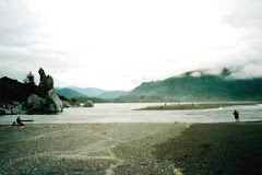
Wooley Creek enters the Salmon River
Van
Kirk and Naman suggest testing this conclusion in the Klamath
Mountains by gaging flows on those watersheds which are largely
roadless and unmanaged. They suggest Wooley Creek (which forms the
heart of the Marble Mountain Wilderness) and the North Fork of the
Trinity River (in the Trinity Alps Wilderness) as the best streams to
gage in order to confirm that wilderness protection also maximizes
stream baseflow. So far, however, neither the Forest Service nor
local restoration councils have implemented that recommendation.
Because of the agency's pro-logging bias, Forest Service managers may
not be eager to collect data which are likely to confirm that
wilderness is the best management if the objective is to maximize
stream baseflow.
Climate change
Climate models suggest that – while precipitation may increase in the
Klamath Mountains as a result of human induced climate change –
temperature will also increase. As a result, while snow pack may
increase at higher elevations (e.g. above 10,000 feet on Mt. Shasta),
at lower elevations - like those in the Klamath Mountains - snow pack
will likely decrease as a result of Climate Change. As Van Kirk and
Naman have pointed out, that change may already be underway.
In the Scott River
Valley it has long been observed by locals that streamflow drops
dramatically when snowpack in the mountains above the Valley is gone.
This typically occurs between early July and early August depending
on the accumulated depth of the snowpack. This suggests that Scott River and tributary flows may
already be suffering from the double whammy of increased irrigation
water use and decreased snowpack. If climate change continues to
reduce Klamath Mountain snowpack the extirpation of Chinook and
Coho salmon from the Scott River Valley and above becomes more
and more likely.
Human change
As snowpack and
streamflow decline the fate of Scott River Salmon will be
increasingly in the hands of those humans who manage Scott River
Basin land and water. Will the state agencies responsible for
enforcing California water and fish protection laws begin enforcing
provisions of those laws designed to protect streamflow? Will private
outfits like the Scott River Water Trust
receive the massive increase in funding needed to lease the water fish
need year after year? Will management of uplands change sufficiently
to make a dent – one way or the other – on Scott River
base flows? Will irrigators voluntarily reduce water use and will
livestock operators stop diverting full ditches to supply stockwater
and instead rely on small, more efficient wells? Will environmental
and fishing groups be successful in challenging ground water pumping
and excessive irrigation diversions?
A “yes”
answers to any of those questions appears unlikely; continued
dewatering of the Scott River appears most likely. That can only mean
the likely extirpation of Salmon from most of the Scott River.
As Jim Denny
pointed out in the mid-1970s, the decline of Scott River Salmon has
been going on for a long time. Early white Europeans observed that
there were so many rotting salmon in the rivers that in the fall they
stunk and rendered the rivers unfit to drink. The Gold Rush had a big impact on salmon but
after the miners left salmon runs recovered. Then came logging and
agriculture. First Spring Chinook were extirpated; then Coho became
scarce. Now Chinook are not making it to prime spawning grounds in
and above Scott Valley during dry years and Coho are also sometimes denied access to spawning grounds when fall rains are delayed.
In modern times
the decline has not been dramatic but it is continual and appears
inexorable. What we now call a “good run” of salmon would have
been seen as a disastrous run failure in the old days. Total
extirpation becomes more likely each year.
Jim Denny called
it “The death of a lady”. Poet T.S. Elliot had another way of saying it:
This is the
way the world ends
This is the
way the world ends
This is the
way the world ends
Not with a
bang but a whimper.

No comments:
Post a Comment